2022年1月26日
English
日本語
JIT/JICA Science and Technology Research Partnership for Sustainable Development (SATREPS)
Research result 2018
On June 14, 2018, the research teams from both Japan and Thailand gathered in Bangkok and held a kick-off meeting to start the international collaborative research period of this project.
In FY 2018, four research topics and activities were set, and each research group worked with collaborators and related organizations to build a research system, collect basic data, and study evaluation methods.
- Group 1 “Leapfrog Urban Design Integrating Land Use and Transportation” (Leader: Prof. Kasanobu Kii, Kagawa University)
- Group 2 “Smart Transportation and Urban Design for Integrated Public Transportation Connections and Street for All” (Leader: Professor Kenji Doi, Osaka University)
- Group3 “Multi-scale Evaluation System for Urban Policy Based on Quality of Life” (Leader: Prof. Yoshitsugu Hayashi, Chubu University)
- Group4 “Integrated Visualization and Decision Support System by Digital Earth System”(Leader: Prof. Hiromichi Fukui, Chubu University)
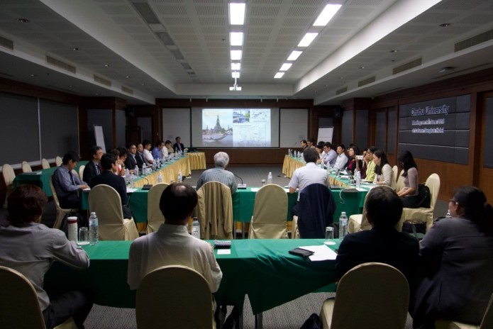
Kick-off meeting in Bangkok 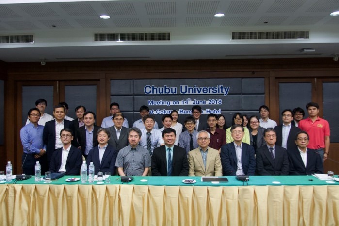
Group photo of the participants
Group1 Leapfrog Urban Design Integrating Land Use and Transportation
The purpose of Group 1 is to compare the road improvement scenario with the transmodal scenario, analyze the long-term impacts of the two scenarios on the urban structure and people’s lives, and present a leapfrog urban strategy, i.e., a path to achieving the SDGs, including environmental sustainability and inclusiveness in cities and communities.
In FY2018, we organized and obtained available data, as well as dialogues with Thai government agencies to organize requirements for land use and transportation design. With the cooperation of Group 2 and Group 4, we obtained available data such as traffic behavior survey data and spatial data of buildings in the Bangkok metropolitan area, and organized them for use in the model. In addition, through Associate Professor Varameth of Kasetsert University, a researcher on the Thai side, we promoted dialogue with government agencies, and learned that cooperation with the Mass Rapid Transit Authority (MRTA) would be effective in providing feedback from a practical perspective to this research project. We found it effective to collaborate with the Mass Rapid Transit Authority (MRTA) to provide feedback on the practical perspective of this research project.
We provided the code of MATSIM, a microsimulation model of the travel path, to Kasetsert University, a research institution on the Thai side, and transferred the technology to enable them to conduct the simulation under hypothetical conditions for Bangkok. With the cooperation of Mr. Miyazaki of Group4, we also established a cooperative system for traffic analysis with Asian Institute of Technology, and promoted cooperation between Japan and Thailand by sharing information and promoting the establishment of an appropriate division of labor.
Group2 Smart Transportation and Urban Design for Integrated Public Transportation Connections and Street for All
Group2 aims to clarify the mechanism of traffic congestion in Bangkok, which consists of multiple factors, and to propose next-generation smart transportation and district design from three perspectives: information systems, mobility services, and spatial design.
In FY2018, to elucidate the mechanism of traffic congestion, we built a simulation model of automobile driving behavior at the Asok intersection in the center of Bangkok, and created a platform for extracting traffic congestion factors and verifying the effects of various traffic congestion measures. In addition, we acquired probe data published by iTIC (The Intelligent Traffic Information Center Foundation) to understand the traffic congestion situation in the central area of Bangkok, and started to build an analysis model to extract traffic congestion mechanisms and bottlenecks. We also started to build a model to extract traffic jam mechanisms and bottlenecks.
From the viewpoint of mobility services, we conducted interviews with local condominiums and other organizations regarding the ideal terminal transportation system using SSVs (Smart Small Vehicles), and confirmed the expected functions and needs of the terminal transportation system, as well as issues related to its implementation.
From the viewpoint of spatial design, we focused on walkability and developed an evaluation model of walking behavior and walking needs for the walking space design through VR evaluation experiments. We also conducted a web questionnaire to understand the values of Thai residents regarding walkability. As a technology transfer to Thai research institutes, we provided equipment for VR evaluation experiments to Kasetsert University, and conducted walking space evaluation experiments for students in Bangkok.
Group3 Multi-scale Evaluation System for Urban Policy Based on Quality of Life
The purpose of Group 3 is to develop a method for evaluating land use and transportation systems based on a factor (QOL/social cost), which is the ratio of the QOL that can be enjoyed by means of transportation to the social cost such as greenhouse gas emissions, and to construct a system that proposes a lifestyle that maximizes the factor. We also aim to develop a system to propose a lifestyle that maximizes the factor. In addition, the project aims to propose policies to promote lifestyle changes that go beyond individual transportation behavior and to evaluate their inducing effects.
In order to evaluate the effect of lifestyle change, the QOL evaluation method based on residence, which has been developed by the group leaders, is not sufficient, so in FY2018, we examined the QOL evaluation method during travel. Specifically, we studied a method for extracting factors that affect QOL using an AI model with subjects’ subjective QOL evaluations of typical videos and images of movement in Bangkok as supervisory data. In order to construct this method, it is necessary to identify the objects that affect QOL, and it is necessary to increase the database so that the AI can identify transportation methods unique to Thailand (such as tuk tuk). Therefore, we devised an AI system to automatically acquire and learn those images, and built an AI system that can automatically identify the type and degree of road damage.
We discussed with Prof. Thanaruk of Thammasat University, who is the principal investigator of the project in Thailand, and Prof. Boonserm of Chulalongkorn University, who is an expert in AI, and worked closely with them to develop the above evaluation method. We also introduced a set of deep learning server systems to Thammasat University and Chulalongkorn University, which are necessary for the operation of the AI-based QOL evaluation system in Thailand, and promoted the technology transfer.
Group4 Integrated Visualization and Decision Support System by Digital Earth System
Group 4 aims to build a system to accumulate spatio-temporal information such as land use, topography, infrastructure (road network and building information), and human information (various traffic probe information and micro-geodata), and to build a decision support system through data aggregation and seamless visualization of the study results in each group.
In FY 2018, we conducted research activities to build a visualization infrastructure using Digital Earth as described in the Outputs section of the PDM and to develop various data environments as described in the Activities section. Regarding the development and maintenance of micro-geodata on land use (PDM Activities 4-2), we coordinated with BMA and other data providers, and conducted basic design for the construction of micro-geodata in the Sukhumvit area. For the development and acquisition of a mobile big data analysis system (PDM Activities 4-3), we developed a prototype equipment to acquire location probes using low-cost Global Navigation Satellite System (GNSS). In addition, for the integrated visualization by digital earth system (PDM Activities 4-5), we have developed a 3D spatial city data system to be used as a basis for multi-scale and seamless visualization and sharing on digital earth of the results of Group 1, 2, and 3 and the data collected by Group 4. We have procured equipment to acquire 3D spatial urban data for the Sukhumvit area, etc., which will be used as the basis for multi-scale and seamless visualization and sharing of the data collected by Groups 1, 2, and 3, and Group 4 on Digital Earth, and have started constructing the data.
We shared the outline of the technology and the progress of the research with the Thai research institutes (Asian Institute of Technology and Thammasat University) in order to build a visualization infrastructure using digital earth as described in the Outputs section of the PDM and to develop various data environments as described in the Activities section. We shared the progress of our research and promoted joint development and technology transfer.